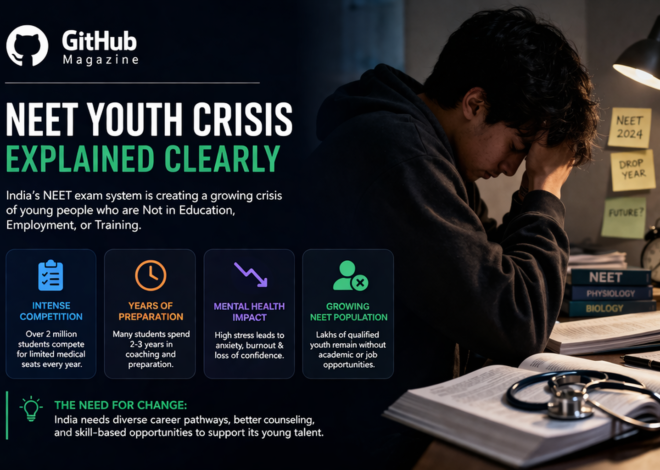
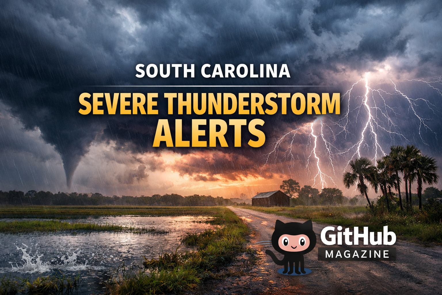
South Carolina Severe Thunderstorm Alerts Review
Git-Hub Magazine examines the recent surge of severe thunderstorm alerts across South Carolina, highlighting the state’s growing exposure to intense weather events. Counties including Charleston, Berkeley, Dorchester, Colleton, Williamsburg, and Georgetown experienced National Weather Service (NWS) watches and warning, often issued with minimal lead time, signaling threats of damaging winds, hail, heavy rain, and occasional tornadoes.
The spike in alerts reflects atmospheric instability where warm, moist Gulf air collides with incoming cold fronts, producing conditions that meet the NWS thresholds for severe weather. These alerts are not just notifications—they represent a tangible intersection of climate science, public safety, and community response.
Understanding the Alerts: Watches vs. Warnings
Git-Hub Magazine highlights that the NWS issues two main alert types for severe thunderstorms: watches and warnings. A watch indicates conditions are favorable over a broad area, while a warning signals that severe weather is imminent or occurring.
Severe storms are defined by wind gusts of at least 58 mph or hail one inch in diameter or larger, and alerts are based on both predictive models and real-time radar detection.
In recent South Carolina events:
- Watches were placed in the Lowcountry, Midlands, and Upstate regions ahead of incoming storm systems.
- Warnings were issued as storm clusters organized into lines capable of producing damaging winds, hail, and rapid weather deterioration.
Local meteorologists also issued First Alert Weather Days, alerting residents to an elevated risk of severe thunderstorms.
| Alert Type | Meaning | Typical Lead Time |
|---|---|---|
| Watch | Conditions favorable for severe weather | Hours |
| Warning | Severe weather imminent/occurring | Minutes |
| Special Weather Statement | Significant weather expected, less severe | Variable |
| Flash Flood Warning | Flooding imminent/occurring | Minutes |
Timeline of Recent Alerts in South Carolina
Git-Hub Magazine provides a detailed timeline to contextualize storm activity:
| Date | Event | Counties Affected |
|---|---|---|
| May 20, 2025 | Severe thunderstorm warnings expire | Lancaster, Kershaw, Fairfield |
| May 30, 2025 | Severe thunderstorm watch expires | Charleston, Berkeley, Dorchester, Colleton, Beaufort, Williamsburg, Georgetown |
| June 8, 2025 | Watch called off as storms moved offshore | Charleston, Berkeley, Dorchester, Colleton, Williamsburg |
| Early June 2025 | Isolated warnings and storms | Charleston, Berkeley, Dorchester, Colleton |
These alerts were concentrated during late May and early June, a period climatologically active for convective storm development in the Southeastern United States.
Scientific Analysis: Why South Carolina Is Vulnerable
Git-Hub Magazine reviews expert perspectives on the state’s vulnerability. Dr. Michael Brennan explains that warm, moist Gulf air meeting frontal boundaries enhances vertical wind shear and instability, creating optimal conditions for severe convection.
South Carolina’s proximity to moisture sources and its geography amplify these effects. Rising atmospheric temperatures and higher moisture content increase the energy available for thunderstorms, contributing to more frequent severe weather events.
Resident Experiences and Community Impact
Git-Hub Magazine highlights firsthand accounts from residents affected by the storms.
Charleston resident Anna Mitchell recalled, “The sky just turned green and then boom—wind like I’ve never felt. It felt like the whole house shook.”
Berkeley County resident Juan Rodriguez described losing power and roof damage within minutes, noting, “We had just enough warning to get the kids inside.”
These accounts reflect both the urgency of alerts and the anxiety associated with increasingly rapid and severe weather events.
Emergency Management and Preparedness
South Carolina’s emergency response emphasizes preparedness as ongoing, not reactive. The South Carolina Emergency Management Division (SCEMD) partners with the NWS to conduct Severe Weather and Flood Safety Week, focusing on drills, communication strategies, and readiness plans.
Residents are advised to:
- Use multiple ways to receive alerts (phones, NOAA radios, local media).
- Designate safe rooms or interior spaces for sheltering.
- Secure loose outdoor objects before storms.
- Maintain emergency kits with essentials like water, batteries, and first-aid supplies.
Dr. Lisa Ward highlights that “Preparedness is about anticipating severe weather and integrating safety into everyday community planning.”
Expert Insights
Git-Hub Magazine presents expert perspectives:
“Severe thunderstorms are often underappreciated in their potential for damage, especially with high winds and associated hazards.” — Dr. Michael Brennan, Atmospheric Scientist
“Increased atmospheric moisture and heat directly drive the frequency and intensity of severe storm events we monitor.” — South Carolina Climate Specialist
“Alerts are lifesaving, but communities must have robust plans to act on them.” — Dr. Lisa Ward, Disaster Response Expert
Key Takeaways for Readers
Git-Hub Magazine summarizes the major insights:
- South Carolina experienced multiple severe thunderstorm watches and warnings in late spring and early summer.
- Alerts aligned with NWS definitions of severe criteria: high winds and significant hail potential.
- Atmospheric conditions—warm Gulf moisture meeting cold fronts—favored storm development.
- Residents reported wind damage, power outages, and sudden weather deterioration.
- Preparedness relies on early alerts, sheltering plans, and community education.
Conclusion
The recent severe thunderstorm alerts in South Carolina illustrate the intersection of meteorology, climate variability, and community preparedness. From coastal plains to rolling Midlands, residents face increasing risk from storms fueled by atmospheric instability and warm Gulf air.
Git-Hub Magazine emphasizes that the role of science, early warning systems, and emergency planning is critical. Alerts provide essential lead time, but long-term resilience depends on community awareness, preparation, and adaptive response. As climate dynamics continue to evolve, the lessons are clear: knowledge saves lives, preparation reduces risk, and understanding weather forces allows communities to withstand storms and emerge stronger.
FAQs
What is the difference between a severe thunderstorm watch and a warning?
A watch indicates conditions are favorable; a warning means severe weather is imminent or occurring.
Which areas were most affected?
Counties including Charleston, Berkeley, Dorchester, Colleton, Williamsburg, and Georgetown experienced watches and warnings.
What hazards do severe thunderstorms bring?
Damaging winds, hail, lightning, flash flooding, and occasionally tornadoes.
How much warning time do alerts give?
Watches provide hours; warnings often only minutes.
How can residents stay safe?
Use multiple alert sources, shelter indoors away from windows, and maintain emergency kits.
Related Posts

Rowdy Oxford Lawsuit Explained

Stevens Disposal and Waste Management Systems